Hydrographic Surveys
We have invested heavily in survey equipment, including six R2Sonic variable frequency high-resolution multibeam systems, Applanix Wavemaster INS systems, numerous custom-built survey vessels and high-end software packages. Our staff are highly trained, degree qualified and hold professional qualifications, including IHO Cat A, as well as RICS chartered status. Staff also hold the relevant HSE, Offshore survival, First Aid and MMO certifications.
Our survey coxswains are MCA / RYA commercially endorsed. Our philosophy of continuous improvement does not end with survey equipment and practices. We also recognise the importance of high quality professional reporting and continue to be at the forefront of innovative data gathering, post-processing methods and modern electronic reporting techniques.
Our philosophy of continuous improvement does not end with survey equipment and practices. We also recognise the importance of high quality professional reporting and continue to be at the forefront of innovative data gathering, post-processing methods and modern electronic reporting techniques.
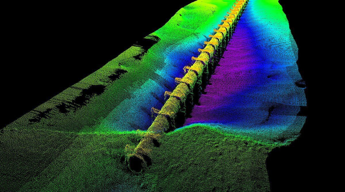
We have invested heavily in survey equipment, including six R2Sonic variable frequency high-resolution multibeam systems, Applanix Wavemaster INS systems, numerous custom-built survey vessels and high-end software packages. Our staff are highly trained, degree qualified and hold professional qualifications, including IHO Cat A, as well as RICS chartered status. Staff also hold the relevant HSE, Offshore survival, First Aid and MMO certifications. Our survey coxswains are MCA / RYA commercially endorsed
We have carried out multibeam surveys within enclosed spaces including caissons, tunnels and below structures, accessed hill lochs by helicopter, travelled over inter-tidal mud-flats by hovercraft, accessed remote coastlines by travelling over land using 4×4 vehicles and trailer, or by piggy-backing smaller vessels on an offshore mother vessel. The acquisition of a remote controlled vessel has further enhanced our capabilities in accessing previously unreachable areas.
We are experts in combining Bathymetric, Oceanographic, Geophysical & Topographic components into single projects. Everything is carried out in-house, from the initial project enquiry through to the final hand over of the survey report, without any need to outsource. This includes project preparation (NtM, RAMS etc), data acquisition, processing and reporting, allowing us to ensure that our high standards are maintained at all stages of the project and that the client is engaged throughout.